


京津冀地區廢棄礦山地質環境治理及生態修復6個方案分析 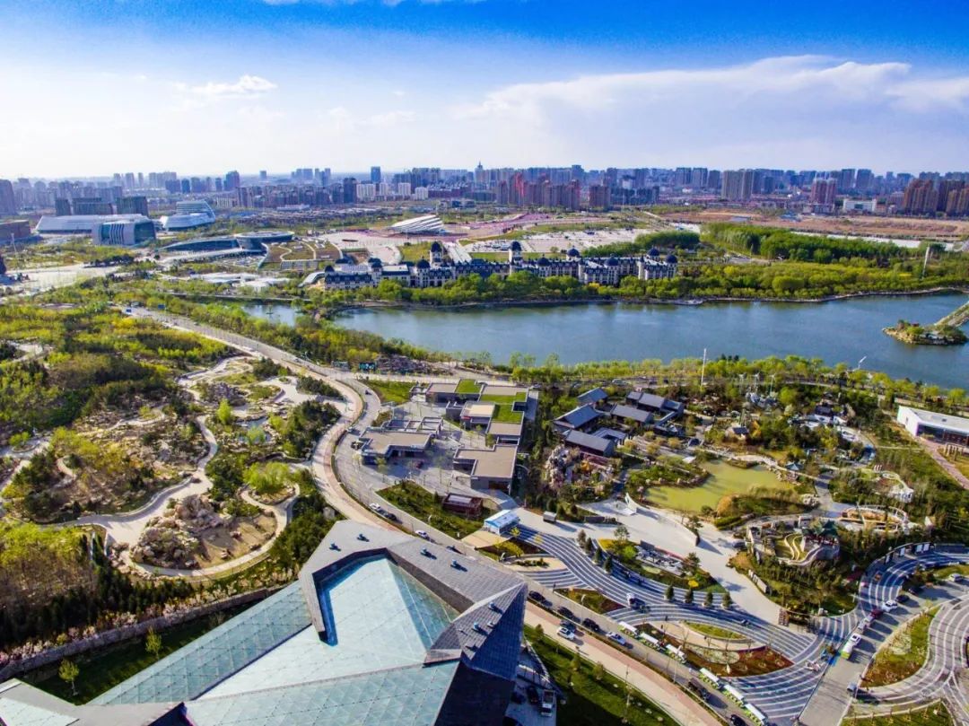
2.礦山地質環境治理及生態修復6個方案 根據礦區的實際情況和區域自然條件,確定廢棄礦山的地質環境治理及生態修復目標,選定地質環境及生態修復的工程技術措施。 2.1 廢棄礦山的治理目標 廢棄礦山治理的總體目標為:改造礦山巖土體、修復水文地質結構、恢復區域生態植被。廢棄礦山治理修復細分目標見表2。
4414
地質GIS帝國 ??? 3年前
某粘土礦礦山地質環境治理及土地復墾探討 
某粘土礦礦山地質環境治理及土地復墾探討感謝原作者:江西省核工業地質局二六七大隊 黃智平 林 峰前言:本文對九江市福興新型建材廠磚瓦用粘土礦礦山的地質環境情況進行了分析,并提出了地質環境恢復治理和土地復墾方案。
4086
礦山地質環境網 ??? 3年前
什么是地質災害危險性評估? 
4.工程水文地質條件良好 5.破壞地質環境的人類工程活動強烈 5.破壞地質環境人類工程活動較強烈 5.破壞地質環境的人類工程活動一般
3004 1 1
礦山地質環境網 ??? 4年前
何為地質構造?典型地質構造圖文分析 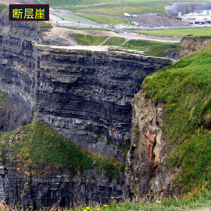
2、地下水的活動和富集,與地質構造有密切關系。3、工程建設必須查明地質構造情況,對地基穩定性作出評價,為工程設計和施工提供地質依據。4、絕大多數地震活動是現代地殼運動的反映,因而震源與地質構造,特別與斷裂構造的關系極為密切5、影響地質環境質量的諸多地質因素中,地質構造是其重要的因素。防止與減少地質災害,地質構造的研究與之有密切關系。斷層的幾何要素1.
6035 1 1
地質GIS帝國 ??? 3年前
感知1毫米微顫,北斗助力「生死避讓」開啟 
此外,北斗系統也可以通過短報文通信技術,向相關人員發送災害預警信息,從而更好地預測和應對地質災害的發生。綜上所述,地面段設立多個基準站和監測站,并與北斗系統結合,可以更快速和準確地監測地質災害,提高災害預警能力,保護人民群眾的生命和財產安全。
2053
千尋位置行業應用 ??? 2年前
機載LiDAR與傾斜攝影測量在地質災害中的應用 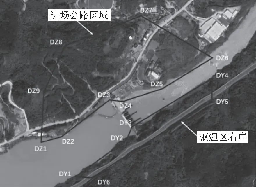
開挖邊坡不利結構面組合及坡面風化卸荷產生有不少危巖,在強降雨、地震等條件觸發下可能發生小規模的崩塌、掉塊;因此,評估區兩岸山坡具備形成崩塌地質災害的地質環境條件[13-15]。3.2 解譯裂縫發育狀況根據無人機航測獲取的正射影像數據,解譯裂縫發育狀況。
4620 1 1
繪夢流光 ??? 3年前
礦業變革進行中,北斗技術賦能智慧礦山 
基于北斗高精度技術的形變監測系統是一種先進的技術手段,可對礦區地質安全數據進行精確監測和采集,形成多種展示形式,包括數據、曲線、平面圖和比較圖等,同時設置預警數據,對整個礦區范圍進行全面監測和控制。這個系統可以將監測數據與其他相關數據(如礦震、沖擊地壓和地質環境)結合起來,進行地質監測的智能化分析,以提高礦區的安全生產水平和決策支持。
2423
千尋位置行業應用 ??? 2年前
海底觀測網技術研究與應用進展 
海底觀測網將供電系統和通信系統直接從陸地延伸到海底,可解決眾多原位觀測設備在海底長期運行面臨的持續電能供給和海量數據傳輸兩大難題,可實現從海底直接對特定海域的物理、化學、生物和地質等過程進行高分辨率的原位實時觀測。
3582
繪夢流光 ??? 3年前
Surpac 6.X顯式3D地質建模
在傳統的地質工作中,地質調查和結果由 2D 地圖(如井段、地質剖面和平面圖)來說明。無法用三維地質現象(如地層、結構和地勢)表示構成了空間信息的損失和扭曲。通過使用 3D 建模和可視化技術,可以理解和直接表達身體和地質環境3D.3D地質建模可以:有效地可視化巖石和時間地層單元的幾何形狀,以定義和控制建模所需的巖石特性的空間分布和擴散。
1882
仿真資料吧 ??? 10月前
2026能源與環境工程進展國際學術會議(AEEE 2026) 
/geological / geotechnical, mineral and energy 地理信息技術在地質環境/地質/巖土工程、礦產和能源領域的發展和應用 ;Geological hazard prediction, assessment, and control 地質災害預測、評估和控制;Remote sensing interpretation of geological structure
2332 1
Lee2050 ??? 4月前
江西省第九地質集團有限公司組建成立! 
按局黨組、隊黨委一隊一企改革要求,第九大隊成立了大隊全資的江西省第九地質集團有限公司(由原核工業華東地勘局二六三大隊勞動服務公司更名),設立集團公司辦公室(董事會秘書處)、財務中心,下設六個公司,分別是:江西省第九地質調查勘查有限公司(由原江西贛核地質礦產勘查開發有限公司更名),原地調院、地環院、生態環境院整合進該公司;江西省第九地質礦產集團有限公司(由原江西瑞拓礦產資源開發有限公司更名
2041
地質GIS帝國 ??? 3年前
無人機通信技術發展方向探析! 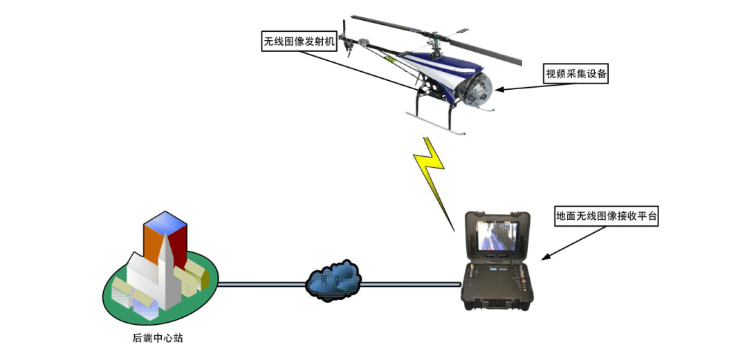
當前無人機通信技術優勢很明顯,但在實際應用中依然擺脫不了“距離”限制,“安全可靠、自主管控"也是技術研究的重點。試想,在6G空天地一體化通信網絡環境下,無人機沒有“通信傳輸”和“高速移動”通信障礙,當前的無人機通信技術解決的關鍵技術問題會是什么?無人駕駛、無人機以及各種智能機器人,都是通信網絡一根藤上不同的瓜,6G標準尚未確定背景下,實現萬物交互及落地平臺會是什么?
2426 1
無人機圈 ??? 3年前
無人機通信技術發展方向探析! 
當前無人機通信技術優勢很明顯,但在實際應用中依然擺脫不了“距離”限制,“安全可靠、自主管控"也是技術研究的重點。試想,在6G空天地一體化通信網絡環境下,無人機沒有“通信傳輸”和“高速移動”通信障礙,當前的無人機通信技術解決的關鍵技術問題會是什么?
2097
無人機圈 ??? 4年前
新思科技解決方案支持NASA“阿爾忒彌斯計劃”,助力航天服分析與通信系統開發 
除了航天服驗證外,Cesium還將三維空間數據與真實月球地形數據整合到新思科技的數字任務工程環境中,利用Ansys RF Channel Modeler?軟件分析射頻(RF)信號的傳播性能。該技術棧中還包含Ansys HFSS?仿真軟件,用于分析安裝在航天服和月球車上的高保真天線模型,深入洞察分析月球表面端到端通信系統的連接性能。
882
Ansys中國 ??? 28天前
基于達索平臺詳解煤炭洗選工程智能化建設難點及案例(含研討會預約) 
包括老舊設備缺乏相應的數據接口、傳感器安裝位置,很難直接融入智能化管控體系;新設備因不同廠家生產,從而設備之間的相互通信、協同工作存在障礙。3.數據質量與利用效率不高。煤炭洗選現場環境惡劣,數據準確性無法保障;大數據挖掘不足,多數洗選廠僅停留在簡單的數據存儲和基本統計層面,缺乏有效的數據挖掘手段,難以從大量數據中提取出有價值的信息。4.數字孿生與全流程協同優化控制處于初級階段。
2645 1
技術鄰公告 ??? 1年前
汽車無線通信芯片—車規AEC-Q100認證 
(5)UWB 芯片UWB,為超寬帶無線通信技術(Ultra Wide Band),通過發送和接收具有納秒或皮秒級以下的極窄脈沖來傳輸數據,從而在3.1~10.6GHz頻段上具有500MHz以上量級帶寬。UWB通信具有穿透力強、功耗低、抗多徑效果好、安全性高、系統復雜度低、能提供精確定位精度等優點,實驗室理想情況可以實現10cm左右的高精度定位,實際環境精度能達到亞米級。
2750
falab ??? 2年前
PPEC32F334RBT7:賦能通信與服務器電源新發展
傳統的通信與服務器電源控制方案在面對復雜多變的網絡環境和高負荷運行需求時,逐漸暴露出開發周期長、調試復雜、靈活性不足等問題,難以滿足行業快速發展的需要。 森木磊石推出的 PPEC32F334RBT7 芯片為通信與服務器電源開發帶來新思路。在通信基站電源中,該芯片的高集成度設計和引腳兼容性備受青睞,可完全替代STM320F28035功能。
1057
用戶_84968 ??? 11月前
PPEC32F334RBT7:賦能通信與服務器電源新發展
傳統的通信與服務器電源控制方案在面對復雜多變的網絡環境和高負荷運行需求時,逐漸暴露出開發周期長、調試復雜、靈活性不足等問題,難以滿足行業快速發展的需要。 森木磊石推出的 PPEC32F334RBT7 芯片為通信與服務器電源開發帶來新思路。在通信基站電源中,該芯片的高集成度設計和引腳兼容性備受青睞,可完全替代STM320F28035功能。
1640
用戶_84968 ??? 11月前
華為Mate 60系列發售,北斗衛星通信技術進一步深入大眾消費市場 
通過以上例子,手機衛星通信這一功能的好處顯而易見。首先,它為人們在山區、海洋、沙漠等弱網無網環境中的安全求助提供了一種全新的手段,這對于戶外運動愛好者、探險者以及經常在這些環境中工作的人們是一項至關重要的生命保障。其次,北斗衛星消息功能在自然災害等突發事件中的重要性不容忽視。
2651
千尋位置行業應用 ??? 2年前
急需地質專家!!!!
(水文地質、工程地質、環境地質、地質工程、勘查技術與工程、資源勘查工程、地下水科學與工程、地質資源與地質工程、地質礦產、地質勘查、地質勘探、地質學、巖土工程、結構工程、防災減災工程及防護工程、水利水電工程、水工結構工程等專業) 有意者聯系:張工17728270394(v同號
2261
用戶_41652 ??? 1年前
20條/頁 
 64
64 跳至頁


技術鄰APP
工程師必備
工程師必備
- 項目客服
- 培訓客服
- 平臺客服
TOP
